words and photos by Don Mankin
CLIMBING AUYAN TEPUI
The wet, slanted face of the boulder looks treacherous. To make matters worse, the bottom edge hangs over a precipitous drop-off with nothing below but air. I’m not sure how I am going to work my way up its slippery surface. As Alejandro reaches his hand out to help me, my boots slip and I slide out of sight. For what seems like an eternity, I am in free fall, not sure how far I will fall or what I will land on when I hit bottom.
Photo Slide Show by Don Mankin
It was the third day of an 8 day trek up, on and down Auyan Tepui, the largest of the table top mountains of Venezuela (tepui means “house of the gods” in the language of the indigenous Pemon people). There are over 100 tepuis in SE Venezuela, ancient sandstone mesas that jut thousands of feet straight up from the jungle and savannahs below. The most famous tepui is Mt. Roraima, supposedly the inspiration for Sir Arthur Conan Doyle’s “The Lost World,” as well as for the hit animated movie, “Up.” Auyan Tepui is larger, more difficult to climb and receives far fewer visitors. It is also the source of Angel Falls (“Paradise Falls” in the movie, “Up”), the world’s highest waterfall at over 3000 feet. Since the tepuis are very old, the flora and fauna that have evolved on the tops of the tepuis are very different than those in the jungles and savannahs below. In fact, the tepuis are like islands in the sky, so each one has plants and animals unique to itself. One of the things they all have in common, though, is that there are no dinosaurs despite the fanciful speculations of Sir Arthur.
My wife Katherine and I were invited here by the owners of Venezuela Elite – a tour company offering trekking, mountain biking, yoga and other trips in the region – to “show Americans that there is more to Venezuela than Hugo Chavez and Miss World” (www.venezuelaelite.com). We only visited one region in our 16 day trip, Canaima National Park, and only Auyan Tepui (the focus of this story), the Gran Sabana and Angel Falls, but from what we saw in those 16 days, their claim is well justified.
Day 1: Up!
Katherine passed on the tepui trek and opted instead for a car-based tour of waterfalls, indigenous villages, and the Gran Sabana – the huge savannah that takes up much of SE Venezuela. In the first hour of the trek I wasn’t sure that she hadn’t made the smartest choice.
After flying in a 4-seat, single engine plane to Uruyen – a tourist camp on the edge of the savannah that is the staging point for our trek – and watching our six Pemon porters distribute and pack the load, we were ready to begin.
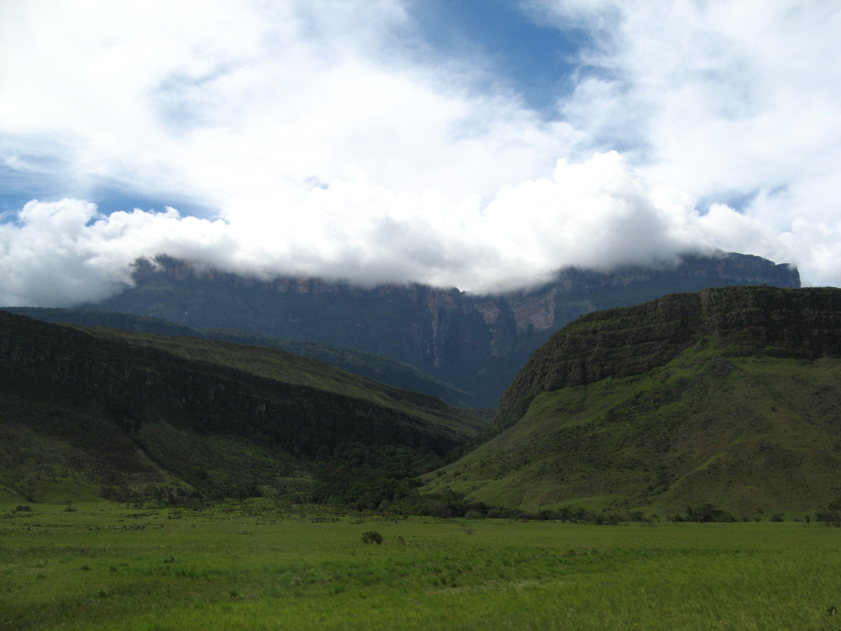
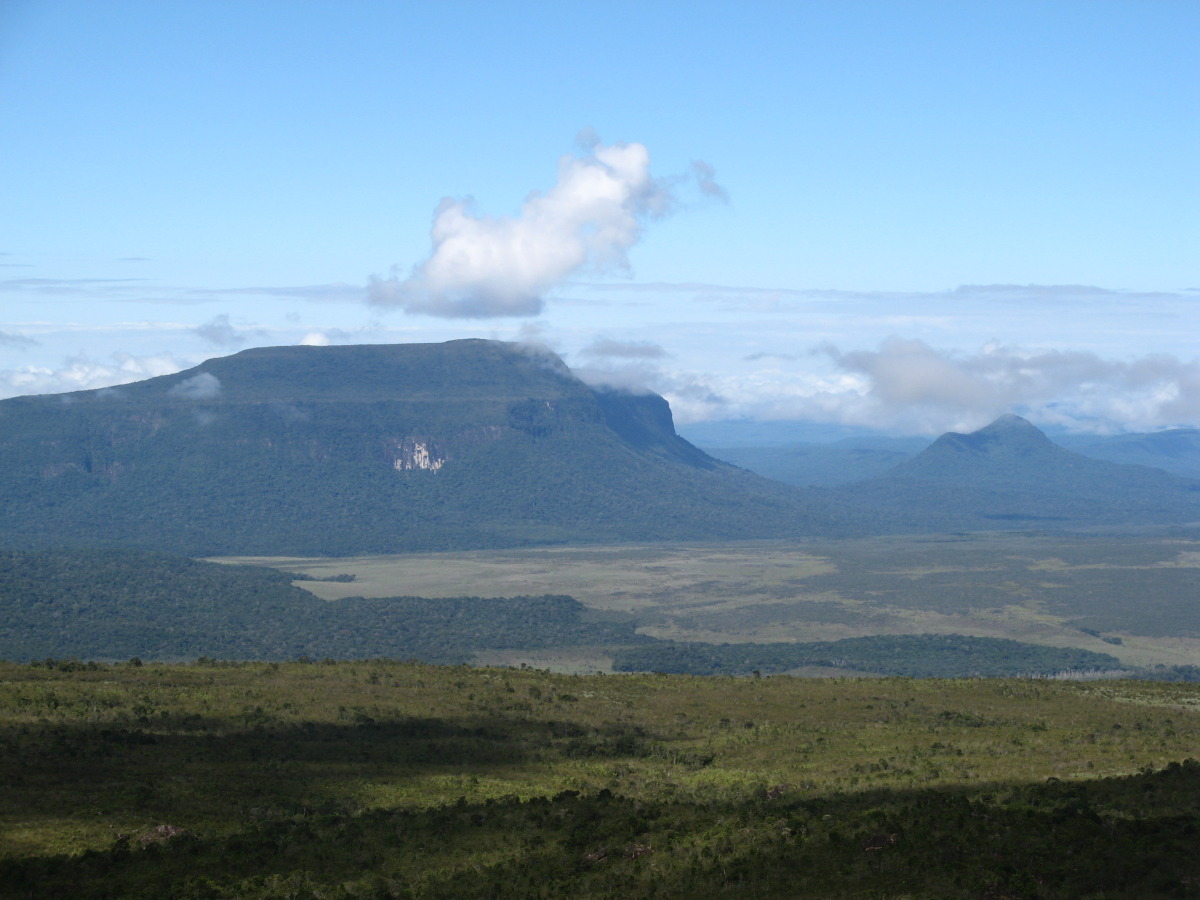
Auyan Tepui loomed several miles in the distance, forming a backdrop for Uruyen and the broad, flat savannah leading to the trail. The tepui is layered like a cake with a steep jungle-clad slope leading to a sheer rock wall, topped by another savannah. The entire tepui seemed to consist of three such layers. Getting to the top of the first layer was the goal for our first day of trekking.
The plan was to get to the top, an elevation gain of over 6000,’ by lunch on the third day. Since we were starting in late afternoon, that would add up to slightly less than two full days of climbing. The total distance we would cover in the 7.5 days of the trek was about 23 miles. It didn’t take a calculator to figure out that this was going to be a steep, difficult trek .
The first part was easy. To save a couple of miles and an hour of walking during the hottest part of the day we rode in a truck over the savannah to the base of the tepui. Then we forded a stream and walked a few hundred yards to the hill that marks the base of the tepui. “So far, so good,” I thought.
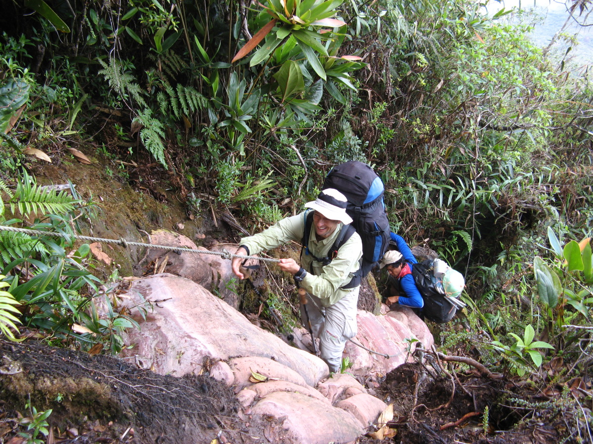
The porters, carrying 30-40 pounds apiece and wearing flip flops, made it look easy. My two guides – Alejandro, one of the owners, and Eduardo, one of his most trusted guides – were also carrying full packs and seemed to barely break a sweat. But after about 10-15 minutes, carrying just a small day pack with a rain shell and lots of water, I was breathing heavier than I had in years. The late afternoon sun beat down on me and the oppressive humidity began to take its toll. I was about ready to give up.
I stopped to catch my breath and wipe the sweat out of my eyes and told the guys, “I’m not sure I can do this.” Eduardo ensured me that I could and suggested that I slow down my pace. That did the trick. After an hour and 45 minutes we were at the top of the first escarpment looking back to see how far we had come.
The view was breathtaking across the wide and deep savannah below, punctuated with clumps of jungle and the geometrical silhouettes of other tepuis in the distance. No signs of civilization, no trails other than our own, no houses, no wires, no wispy airplane entrails. The only footprints were our own.
Forty five minutes later we made it to our first camp. We took a dip in the first of many streams warm enough to slide into but cool enough to refresh. After a surprisingly sumptuous dinner I crawled into my tent and sleeping bag for our first night on the slopes of the tepui. It was only 8 pm. I felt content and hopeful, thinking as I drifted off to sleep that maybe I could do this after all.
Day 2: Further Up!
The next day the climb continued. This was the steepest, rockiest trail I had ever climbed. It’s actually not much of a trail at all, just an uneven staircase of rocks, boulders and roots through the jungle, only occasionally, but mercifully, broken up by a relatively flat stretch of sandy trail across the savannah to the next staircase through the jungle. Along the way branches scraped my arms and legs as I passed by and vines grabbed at my ankles.
The only thing that distracted me from the sheer effort of climbing and the concentration needed to avoid a misstep through this ankle-crunching, knee-twisting mine field of rocks and roots was the thought that as difficult as this was, it would be nothing compared to coming down, especially on my bad knees.
Day 3: To the Top and Beyond
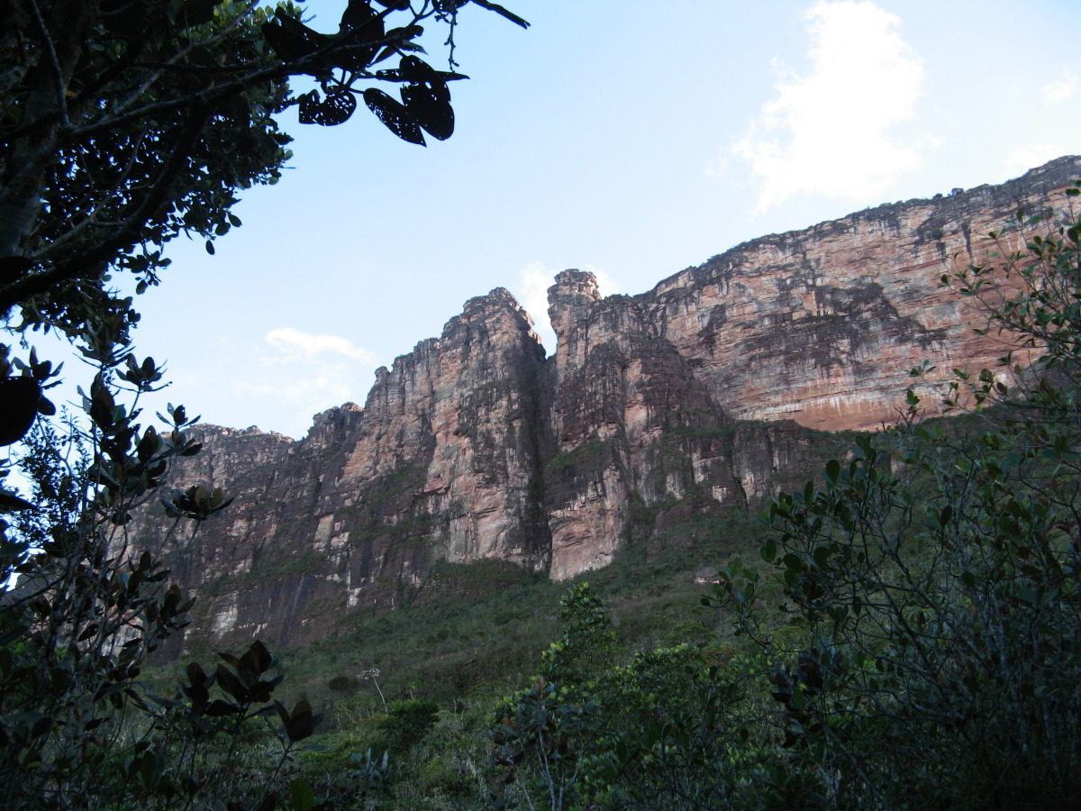
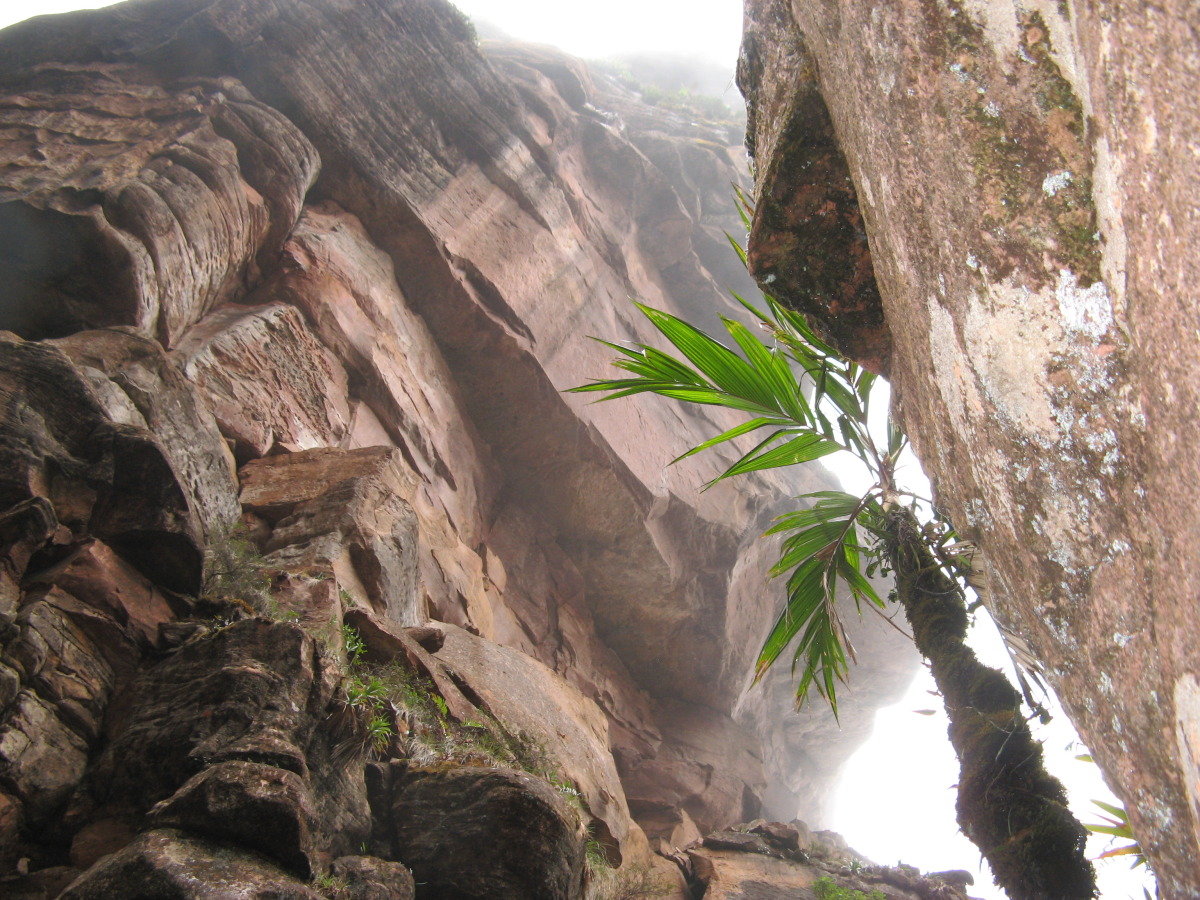
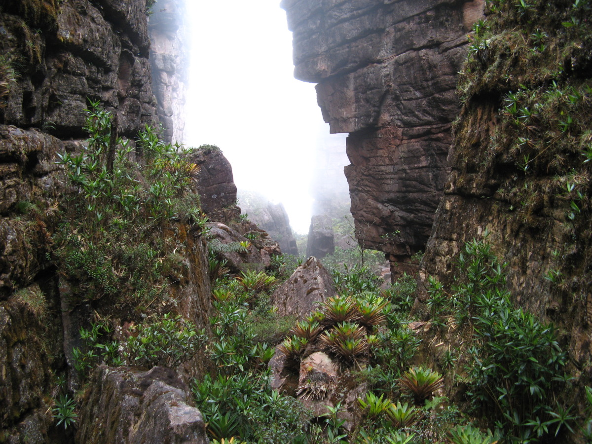
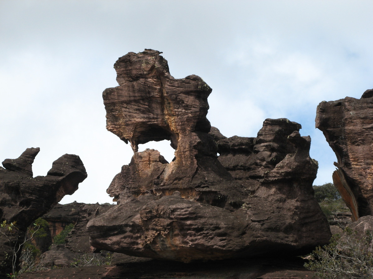
The last stretch to the top was one challenge after another. The first part involved another long, steep climb through the jungle, then we picked our way over and through a maze of large roots until we reached the base of the last wall, an escarpment of sheer rock several hundred feet high. The trail led up a gully through a break in the wall between a large rock spire on the outside and the rock wall on the inside. This was the “Enchanted Garden,” a corridor of boulders and lush ferns and other flora, like an exotic, giant rock garden. To make things really interesting, at several points we had to use fixed ropes – “rope passes” – to pull ourselves up the faces of the largest and steepest rocks. The overall effect was like a combination of a jungle gym, playground and obstacle course, with incredible scenery!
I was so absorbed by the challenge, and having a great time doing it, that I was surprised when Alejandro informed me that we are on the top. I made it! I was almost sorry it was over. Then it started to rain, hard. The water had no ground to sink into so the rivulets of rain in the rock soon turned into streams, then rivers. The rock surface became very slick, and we picked our way carefully over the slippery surface for the next two hours. I did OK, falling only once, until we were within a half mile of our campsite.
It was when we were negotiating a particularly difficult jumble of rocks that I slipped and slid down the rock, out of sight. A retrospective of my life did not flash before my eyes, but I did have enough time to realize I was in serious trouble. But instead of crumbling, broken, on a pile of rocks, I plopped thankfully into a moss-lined pool of water!
After patting myself down in a search for broken bones and looking around for a place for a rescue helicopter to land, I realized I was unhurt except for a couple of sore ribs, but I was visibly shaken. We soon found another way through the boulders, only slightly less hairy, and made it to our campsite a few minutes later. I was happy to see that the campsite was protected from the rain by a huge slab of overhanging rock. That night I slept fitfully, constantly trying to find a comfortable position that spared my sore ribs.
Days 4 and 5: Resting and Testing
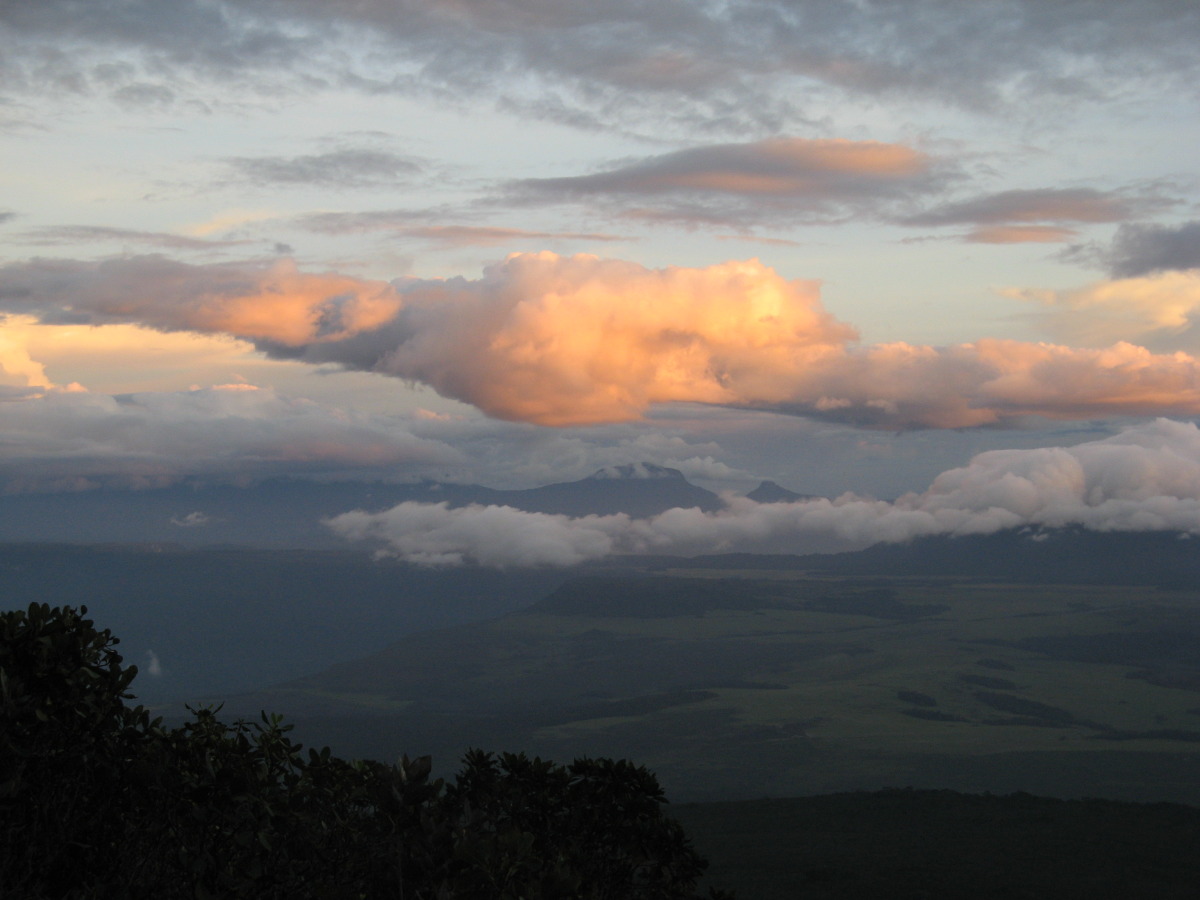
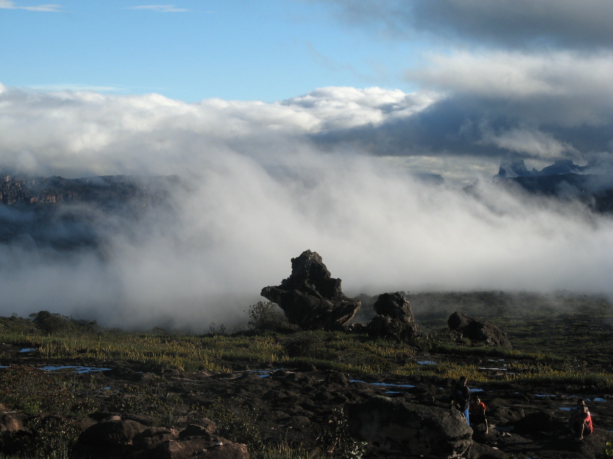
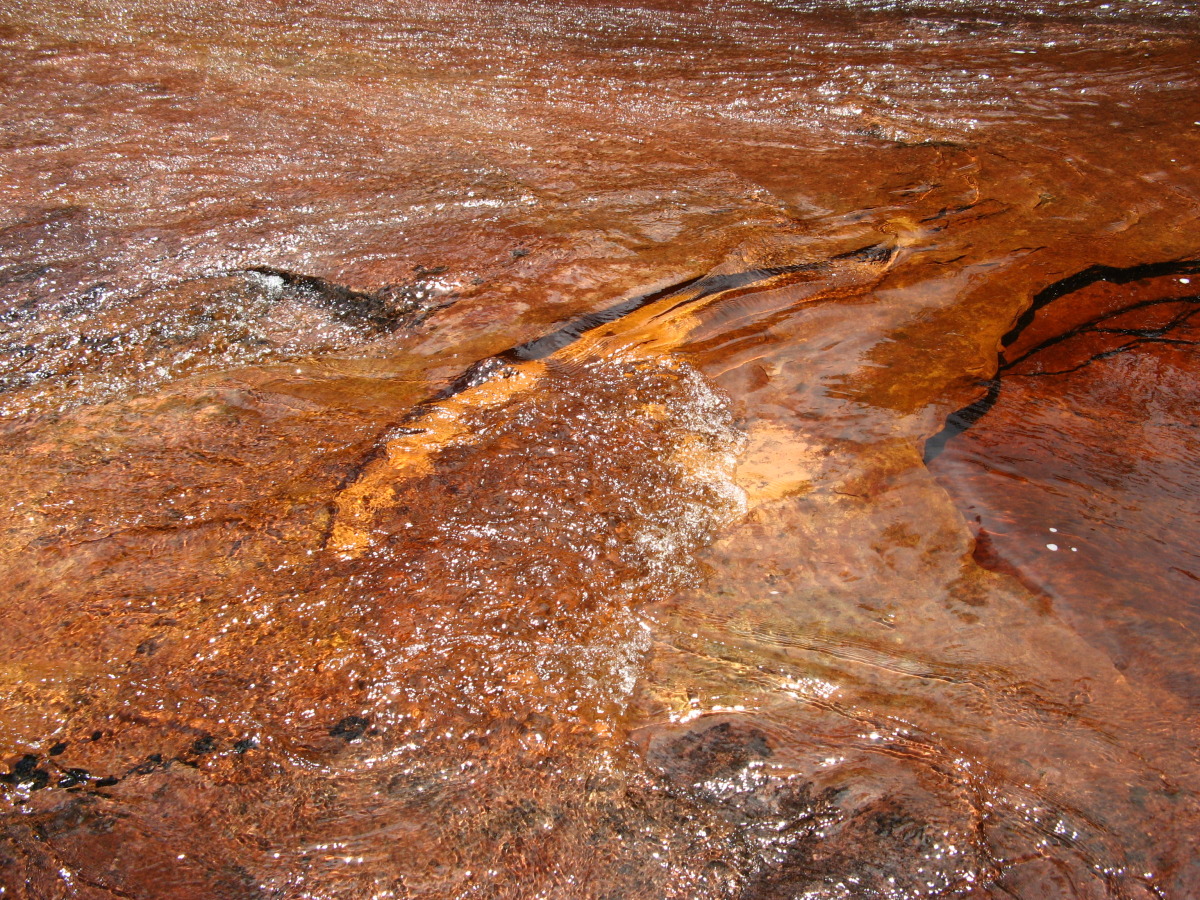
We decided to stay at our protected campsite for a couple of days to take time to recover, test my ribs and explore the area within a couple of miles of our camp. The landscape looked like Mars -- black, craggy sandstone cut into rough, bizarre shapes by wind and rain, broken up with patches of low bushes and shrub. The plain that stretched out before our camp was actually a valley between two continuous sandstone cliffs on each side. The vast view across the rocky plain was cut through with cracks and canyons where rivers run, eventually turning into waterfalls. Tannins from the bushes and shrubs on the banks stain the rivers bright orange.
The raw, mysterious beauty seemed to change by the minute as the sun came out, mist drifted through the canyons, clouds rolled in and rain transformed the channels in the rocks into temporary rivers.
This the place where we come across the only other people we saw since we started – a party of six surly Russians, with porters. The apparent leader was a broad-browed Neanderthal wearing camos with cut off sleeves, straight out of a Robert Ludlum novel. His fashion model girl friend was dressed in a see-through net top, a long duster and a stylish over-the-shoulder handbag more appropriate for night clubbing in Moscow than climbing a tepui.
We learned later from their porters that one of them was carrying a gun. We noticed that he was always separate from the others, keeping at a distance where he could watch them and see anything or anybody that approached (dinosaurs, assassins, CIA agents?). We guess that he was a body guard and that the broad-browed guy was a high up in the Russian military taking a break from his negotiations with Chavez over the sale of arms. From his unfriendly demeanor we figured that we were not supposed to see him…
Days 6-7: Back to the Brink, Then Down…and Down!
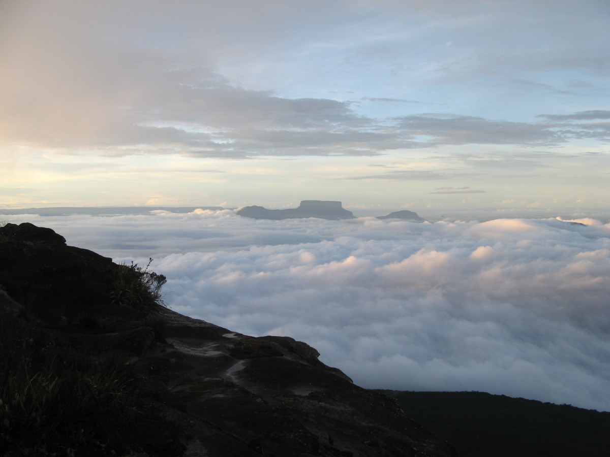
On our last day on the top we headed back to where we emerged a few days before from the Enchanted Garden and reached the top of the wall. It was a relatively easy hike with just a few steep sections and rope passes. We camped almost on the edge, and by leaning close to the edge, we were able to see the trail through the Enchanted Garden. The ghostly shapes of the rock spires framing the route peeked through, then faded in the drifting mist. We could see the tops of other tepuis in the distance floating above the clouds. Occasional breaks in the clouds revealed the entire tableau of jungle slopes leading down to the savannah below.
Early the next morning we started our descent. The plan was to descend in two days what it took three days to climb. I guess for most people that makes sense since it is generally easier going down than up. But on my bad knees this was possibly the most grueling day of hiking in my life to that point. It was a very steep, muddy and rocky descent that required constant focus on each step. We had to climb over and around large rocks and slippery roots that were ready to trap and break errant ankles. I ran out of gas by mid afternoon. Even though we were 2-3 hours short of our goal for the day, I just couldn’t go on. We stopped for the day at another campsite protected by a rock overhang. It was a good thing we did since it poured all night.
Day 8: The Big Finish
An even longer and more grueling day; about 11 hours of tough downhill hiking. But I was in a better state of mind since I knew what I was in for, and I also knew that it was the last day. My wife and a shower waited for me at the end. We kept up a good pace throughout the day, but we still didn’t reach the top of the first escarpment until late afternoon. We could see our goal – the long valley leading to Uruyen and the road where the truck would pick us up. But it was still 2-3 hours away.
As we got closer to the end, we really started to hustle. The sun was setting, the fireflies were out and all I could think of was the stream we had to cross at the end, the one we had picked our way across rock by rock on Day 1. How was I going to do that in the dark? I went all out like I was finishing a race in a desperate attempt to get to the river before it grew completely dark. I felt like a runner entering the final lap at the end of a marathon – lots of people around (mostly the porters and guides) cheering (actually shouting instructions). I remember someone telling me to forget walking across the stream on the stones, just step in the water. No need to worry about wet boots at this point. One of the porters guided me across, bracing me in case of a misstep.
I made it across without a problem. Only a hundred yards or so to the car. It was almost completely dark now except for the fireflies and the silhouettes of three figures above us on the road. One silhouette looked familiar as it moved toward me in the dark, and then I heard, “Mankin, you made it.” Katherine ran up to me and we embraced in a very sweaty hug. Only one other thing came close to matching that moment – the ice cold can of beer that Eduardo took out of the cooler in the back of the truck and passed to me in celebration.
Author Don Mankin ©Alejandro Gonzalez viaVenezuela Elite
Don Mankin is a travel writer, business author, psychologist, organizational consultant and executive coach. The Wall Street Journal called his latest book, Riding the Hulahula to the Arctic Ocean: A Guide to 50 Extraordinary Adventures for the Seasoned Traveler (National Geographic, 2008), “one of the best travel books to cross our desk this year." For more information on Don or Riding the Hulahula, check out his website http://www.adventuretransformations.com.